
Belmont, Massachusetts
The Town of Homes
A Brief History of Belmont
Belmont was incorporated on March 18, 1859, formed from portions of Watertown, Waltham, and West Cambridge (now Arlington). The town was named after the 200-acre “Bellmont” estate of John Perkins Cushing, a prominent merchant and financial supporter of incorporation.
But Belmont’s roots go back much further. The land was originally part of early 17th-century Watertown settlements, which developed as agricultural communities. For nearly 300 years, Belmont was defined by farms, orchards, dairies, and greenhouses supplying produce to Boston’s markets. Strawberries, pears, apples, and greenhouse-grown vegetables made Belmont known throughout the region for quality and scale. The same cannot be said about the conditions of our paved roads, but I digress.
By the early 20th century, the arrival of railroads and trolley lines transformed Belmont from a farming community into a desirable commuter suburb. The Fitchburg Railroad, now the MBTA Fitchburg Line, helped shape the development of Belmont Center and Waverley Square. As Boston expanded, Belmont evolved into what became known as “The Town of Homes,” a primarily residential community with strong neighborhood identity. The moniker has trade-offs, as in today’s society we love the convenience of restaurants and shops in close proximity to where we live. This has resulted in the town exploring expanded development in Belmont Center, Waverley Square, Pleasant Street, and the Brighton Street Corridor. Belmont Hill is often recognized for its larger homes, elevated topography, schools like Belmont Day and Belmont Hill School, and conservation land. Most residents live in the flatter neighborhoods surrounding the Hill. Many of our streets are lined with early 20th-century Colonials, Victorians, and mid-century homes, on well-established lots that reflect the town’s agricultural past. You can still see that history in unexpected places, mature pear trees, former farmhouses, and preserved open spaces like Rock Meadow and Lone Tree Hill.
Waking up on a Saturday morning with two littles and no immediate plans is always a “what were we thinking" moment. The problem becomes exacerbated when there’s no sports scheduled. That being said, after the children became mobile we developed our own family routines and outings to get out of the house and get some wiggles out to control the day as best as we can.
The day typically starts with breakfast and caffeine, and if we are not eating at home, we have more than enough options. On warmer days, we will walk to Cushing Square and visit some local favorites depending on the mood: Starbucks, Ovenbird Cafe, Teddy’s Kitchen, and Bakehaus in no particular order. Each offers a variety of grab and go or sit down options for both breakfast and lunch. Many patrons make the mistake of trying to squeeze in a lot or park right in front of these venues, but the Square has neighborhoods on all sides that offer plenty of street parking and a short distance to wherever you are heading. If we head to Belmont Center, we are visiting either Quebrada, Butternut Bakehouse, Bellmont Caffe (Do not sleep on their Pistachio latte), or the Black Bear Cafe. Parking has gotten tighter over the years, but there’s still plenty even if you have to be patient. If you are going to the West End of town, Tatte is a new favorite and a great place to sit down. Their coffee is great and their breakfast is underrated.
When we are not in Hockey that occupies our Saturday mornings, what else can we possibly do to stay out of the house? Winters are especially hard, and at time of writing there’s still over a foot of snow on the ground, meaning our Spring and Summer walks to Payson Park, the soon to be new park at Chenery, or Wellington School are out of the question. Prior to the new Library’s construction, the Benton Library on Oakley Road previously held the entire children’s section of Belmont’s catalog. Now that the Library is fully operational, Benton is back to being a private library, meaning the fight for parking on Concord Ave is imminent. Otherwise, we are staying in the Center for Belmont Books. The second floor children’s section is quiet, and we’re always looking to add to our collection. If they don’t have something particular you are looking for, they are happy to order it for you.
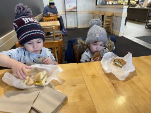
Breakfast on the Town

Jack DelRose enjoys a treat at the Beaver Brook Reservation
If you have children under the age of 5, I’m not going to lie, it’s simply a difficult age to find activities to keep them occupied on your own schedule. It’s birthday parties and play dates as much as possible to an extent. When they do reach a certain age, Belmont Recreation has many activities and is a great resource for the whole family. For youths, adults, and seniors, there are activities for everyone. Art, Basketball leagues, Camps, General Sports Clinic, Dancing, Hockey, pickleball, Restaurant Manners Classes for Children, or tennis leagues, theatre groups, improv classes, swimming, Teen Committee, painting, Zumba, etc. These events take place at various points in the week, but there’s so much going on that there really is something for everyone.
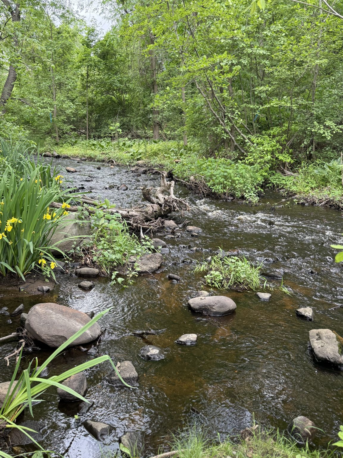
If we’re not running errands or spending time with Family and Friends, afternoon jaunts in town typically involve getting outside when we can. While technically not in Belmont, Beaver Brook Reservation on the Waltham line is a park with a paved trail, tennis courts, and a bubbling brook. It’s simply great for exploring, walking the dogs, or running around. A spray pad and playground is accessible via Trapelo Rd, originally pronounced “Trap-ello” for the beaver trappers that once worked in the area according to local historians. In the Summer, I take great joy in getting to grab a treat when the ice-cream truck comes around. No parents are telling me no. They take venmo. Even having the truck there is an indication of just how busy it is. The numerous picnic tables are usually full and the playground is hopping. Definitely a fun place to be in warmer weather.
And If you like a bit of older history, Rock Meadow was created 10,000 years ago by glaciers. It hosts Victory Gardens, one of the older community gardens in the Greater Boston area, and quite large. With taller grass in the area, beware of ticks, however a great place to visit nonetheless, maybe not so much for the littles, but for those looking for some peace and serenity outside.
Where Belmont lacks currently is its nightlife. It’s not that there aren't plenty of restaurants and venues around the corner, because there are. However Belmont hasn’t really had a watering hole to be proud of since Trinktisch closed down a few years ago. A beer garden in Belmont Center with parking was exactly what locals needed for low key fun. Similar options now are town-favorite Conley’s In Watertown and The Mighty Squirrel Brewing Company over the Waltham line. Both are great venues nearby. Fun fact that you probably don’t care about: I had my second date with my now wife at Conley’s. Also fun fact. She hasn’t figured out that she could have done better. Kidding of course.
Fortunately, Belmont does have a good restaurant scene. The Spirited Gourmet in Cushing Square hosts wine tastings on Friday evenings. They are also known for amazing sandwiches, cheese, and other specialty goods. Savino’s Grill across the street is also a restaurant I would recommend, located just across the street from the Gourmet. On the outside of Cushing Square is Hanami Sushi. Live music, great drinks, and a delicious menu. Their venue took the place of long-time Belmont staple and crafts store, Ben Franklin’s. While it pained me to see my childhood haunts close up shop, it was nice to see such a good restaurant move in.
If we head back to the Center, other venues are worthwhile to check out in the evening. The Wellington, Patou Thai, il Casale, Gregory’s Pizza, La Victoria Cafe, and of course town favorite Rancatore’s Ice Cream are all worth visiting. Those places keep the area packed with people well into a weekend evening and are all worth visiting. I have another spot that’s kind of a hidden secret. Comella’s, which hit the scene in Belmont Center years and years ago, made a big splash with $5 cheese pizzas. They’re still here, in a bigger space on Flanders Rd off of Brighton Street. The pizza is still good, but they also have a bar and suitable areas to watch sports. It’s not taken advantage of nearly enough. You’re welcome.
Our Saturdays are always different, and it's been a hot minute since I’ve gotten to visit every business I mentioned. I wanted to make the effort to show you that there’s a lot going on in the area, and you don’t necessarily have to leave town to find things to do. Growing up here myself, I used to walk everywhere to spend time with my friends. Although life is a little busier for me now, you absolutely have the ability to still do just that.
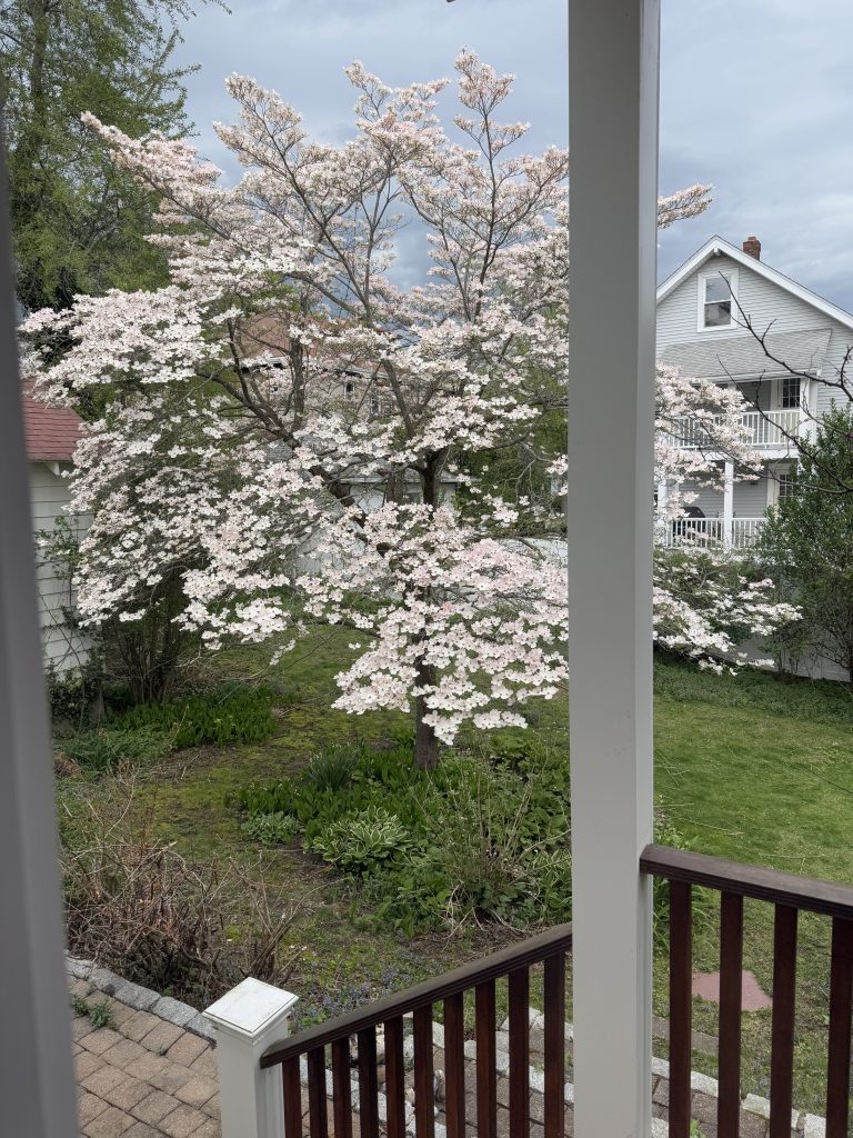
Seasonal Views
Belmont, MA has a rich agricultural history, once known for its farms, greenhouses, and sprawling orchards that supplied fresh produce to Boston. The Chenery neighborhood, in particular, was originally part of a large orchard, with remnants like historic fieldstone walls still visible along Selwyn Road near Payson Park. Today, that legacy lives on in the area’s mature trees and seasonal beauty—especially in the spring, when flowering dogwoods and other ornamental trees come into bloom. Many longtime residents recall pear, cherry blossom, and crabapple trees throughout neighborhood yards, a lasting reflection of Belmont’s orchard roots and enduring charm.
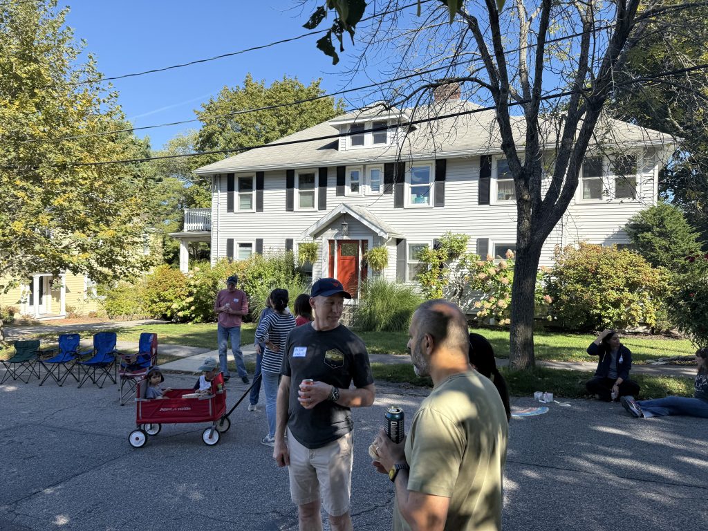
Chenery Neighborhood Block Party
Every year, the Chenery neighborhood in Belmont, MA—especially along Selwyn, Hurd, and Washington Streets—hosts a beloved block party that brings neighbors together for a community cookout and gathering. The town temporarily closes the streets to traffic, creating a safe and relaxed environment where residents can connect, children can play freely, and families can enjoy food, music, and conversation. Events like this highlight the strong sense of community that defines Belmont, offering a glimpse into the neighborhood lifestyle that makes areas like Chenery so desirable.
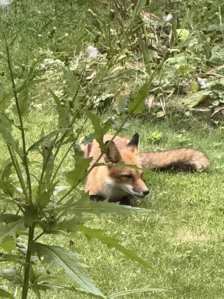
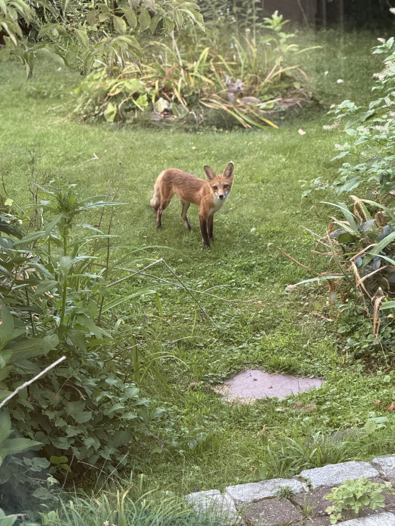
A Fox Resting
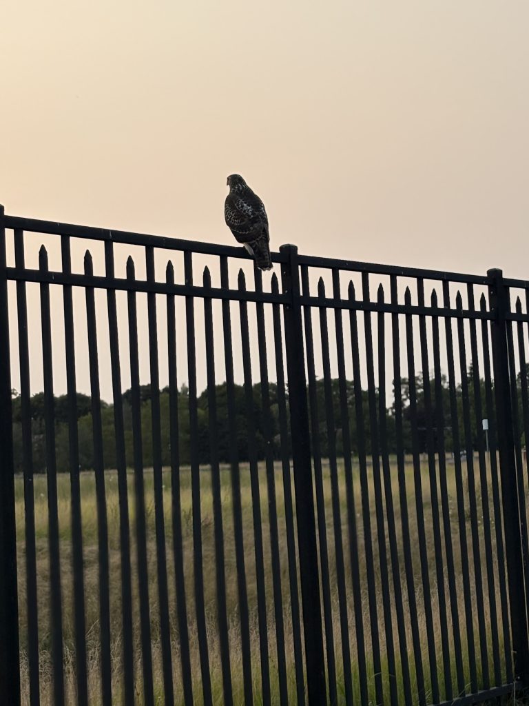
Wildlife in Belmont, MA—particularly in neighborhoods like Chenery—has become increasingly diverse since the 1990s, with a growing presence of both small mammals and bird species. While earlier decades were dominated by common suburban wildlife such as squirrels, skunks, and songbirds, today residents frequently encounter rabbits, foxes, raccoons, chipmunks, hawks, and more. This increase in biodiversity reflects the area’s mature tree canopy, green space, and evolving ecosystem.
Red foxes, in particular, have become a notable part of the local wildlife. In 2025, a family of foxes settled into the Chenery neighborhood, drawn by an abundant population of rabbits and small rodents. Foxes are most active during early morning and evening hours, and it’s not uncommon for residents to spot them along quiet residential streets or in backyard spaces. Despite their presence, foxes are generally shy and non-aggressive, often observing from a distance or passing through as they hunt.
Moments like this—capturing a fox resting or moving through a backyard—highlight the unique blend of suburban living and natural habitat that defines Belmont. For residents, it’s a reminder that even in a well-established neighborhood, nature remains an active and visible part of daily life.
Photogenic Fox
Red foxes in Belmont, MA—especially in neighborhoods like Chenery—have become a familiar and fascinating part of the local wildlife. This particular fox is a frequent visitor, often seen observing residents from the yard with a curious but cautious demeanor. While foxes are naturally shy, they can appear playful and inquisitive when they feel undisturbed. Sightings like this highlight the unique blend of suburban living and active wildlife that makes Belmont’s neighborhoods both vibrant and connected to nature.

Fox Prepares For A Nap
Red foxes in Belmont, MA are typically most active at dawn and dusk, but daytime sightings have become increasingly common in neighborhoods like Chenery. This fox is a frequent visitor to a local backyard, where it can often be seen resting, feeding, or stretching out for a midday nap. It’s not unusual for foxes to curl up for an hour or two before continuing on their daily routes. Moments like this highlight how adaptable wildlife has become in Belmont, blending natural behavior with suburban living.
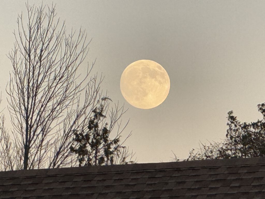
Super Moon
A super moon in Belmont, MA—captured here in the Chenery neighborhood—highlights one of several notable celestial events visible in the area during 2025–2026. As the moon rises low on the horizon behind homes on Hurd Road, its scale appears dramatically larger, framed by rooftops and surrounding foliage. Events like this showcase Belmont’s unique balance of suburban living and open sky visibility, offering residents memorable views of astronomical phenomena right from their neighborhood streets.
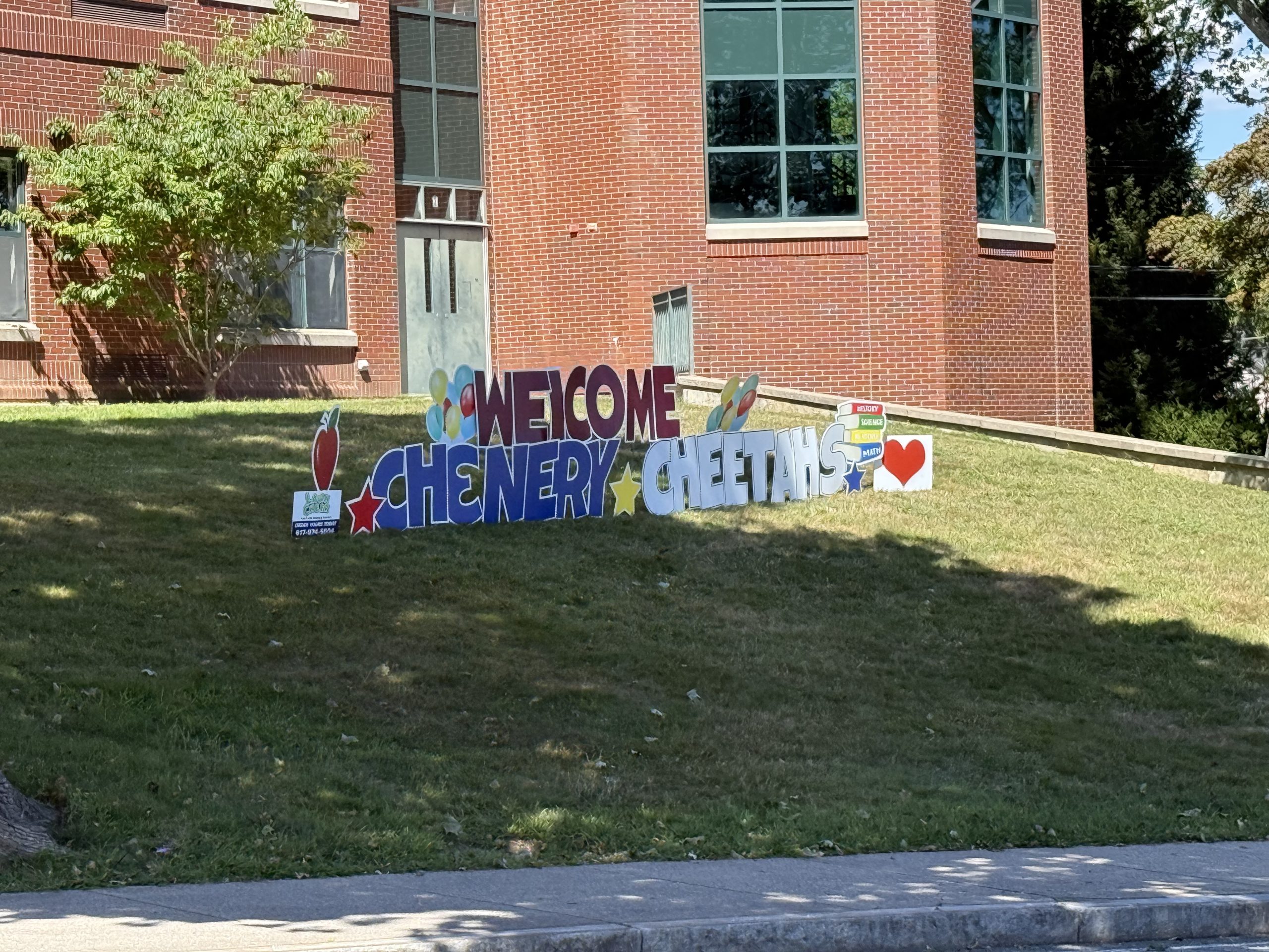
Welcome Back!
Chenery Upper Elementary School in Belmont, MA welcomes students each fall with community-driven traditions like this “Welcome Back Chenery Cheetahs” sign, displayed at the corner of Oakley Road and Washington Street. Created by teachers and staff, the sign reflects the strong sense of school pride and neighborhood connection that defines the Chenery area. Moments like this highlight the supportive, family-oriented environment that makes Belmont’s schools and neighborhoods especially appealing to residents.
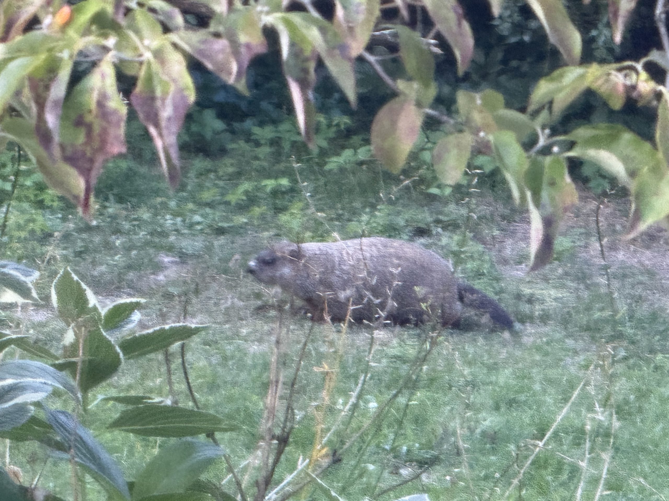
Resident Groundhog
Groundhogs in Belmont, MA—also known as woodchucks—have become increasingly common in neighborhoods like Chenery, where they can often be seen foraging in residential yards. While groundhogs have long existed in the area, sightings were far less common decades ago. Today, several are known to inhabit the neighborhood, including this frequent backyard visitor. Groundhogs are naturally shy and will quickly retreat to their burrows if startled, but their presence is another example of the growing suburban wildlife ecosystem in Belmont.
Beaver Brook
Beaver Brook Reservation is a historic 303-acre public park in Belmont and Waltham, established in 1893 as the first reservation in Greater Boston’s Metropolitan Park System. Originally created to protect the iconic Waverly Oaks—a grove of 22 ancient white oak trees preserved by landscape architect Charles Eliot—the park reflects the early vision of regional conservation. Although the last of the oaks fell in the 1920s, the reservation still features historic elements including land once owned by landscape architect Robert Morris Copeland, a monument to the Waverly Oaks, and remnants of a 19th-century mill.
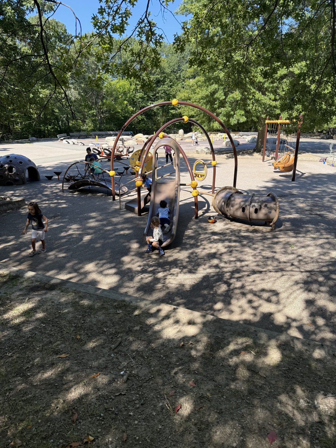
Beaver Brook Reservation Playground
The Beaver Brook Reservation playground and splash pad in Belmont, MA is one of the area’s most popular summer destinations for families. The playground features separate areas for toddlers and older children and is frequently used by local schools during the day. In warmer months, the spray deck (splash pad) becomes the main attraction, often drawing hundreds of visitors on hot days. The area includes covered picnic tables, benches, and public restrooms, making it ideal for extended visits. Ice cream trucks are a common sight, adding to the family-friendly atmosphere. Parking is limited along Trapelo Road and Waverly Oaks Road, so access can be challenging during peak times.

Belmont's Learn To Skate Program
The Skip Viglirolo Rink in Belmont, MA is a newly rebuilt, state-of-the-art ice skating facility that reopened in late 2025 as part of a $32 million investment in the town’s recreational infrastructure. Originally constructed in the late 1960s and later enclosed for year-round use, the rink has long been a cornerstone of Belmont youth hockey and community programs. The new 40,000+ square foot facility features a full-size NHL rink, modern locker rooms, and sustainable design elements including CO₂ refrigeration and solar panels. Named in honor of longtime Belmont coach and mentor Skip Viglirolo, the rink reflects both the town’s deep hockey tradition and its commitment to modern, community-focused amenities.

Touch A Truck Event At Belmont Fire Department
The Belmont Fire Department Touch-a-Truck event, typically held at Belmont Fire Department Headquarters or near Belmont Center Station, is a popular family-friendly community event where children and residents can explore fire engines, ambulances, and public safety vehicles up close. Hosted periodically by Belmont’s fire department, the event gives kids the chance to climb into trucks, spray a fire hose, and interact directly with firefighters through live demonstrations. It’s a hands-on experience that highlights the department’s commitment to community engagement and public safety, while showcasing the welcoming, service-driven culture that defines Belmont.
The Reservoir
The Reservoir in the Payson Park neighborhood is a unique historic water reservoir and scenic outdoor space owned by the City of Cambridge. Constructed between 1894 and 1897 atop Pequossette Hill, the 163-acre site holds up to 43 million gallons of drinking water and remains an important piece of regional infrastructure. Today, the enclosed reservoir is surrounded by a dirt path popular with Belmont residents for walking, running, and biking, offering elevated views of the neighborhood and even the Boston skyline. Blending history, open space, and everyday livability, the reservoir is a defining feature of the Payson Park area.
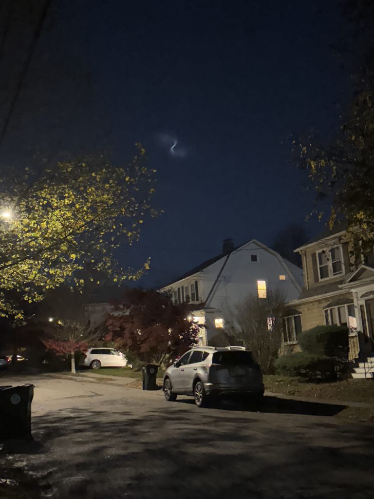
Space Debris Over Chenery
Unusual night sky phenomena in Belmont, MA—like this spiral-shaped space debris captured over the Chenery neighborhood—offer residents a rare glimpse of activity beyond Earth’s atmosphere. Observed while looking southeast to northwest, the formation appeared as a wispy spiral moving steadily across the sky, likely caused by a rocket launch or satellite-related event. Between 2025 and 2026, several similar celestial sightings have been visible from Belmont. While light pollution limits full night sky visibility in Greater Boston, moments like this highlight the surprising and memorable views that can still be experienced from suburban neighborhoods.
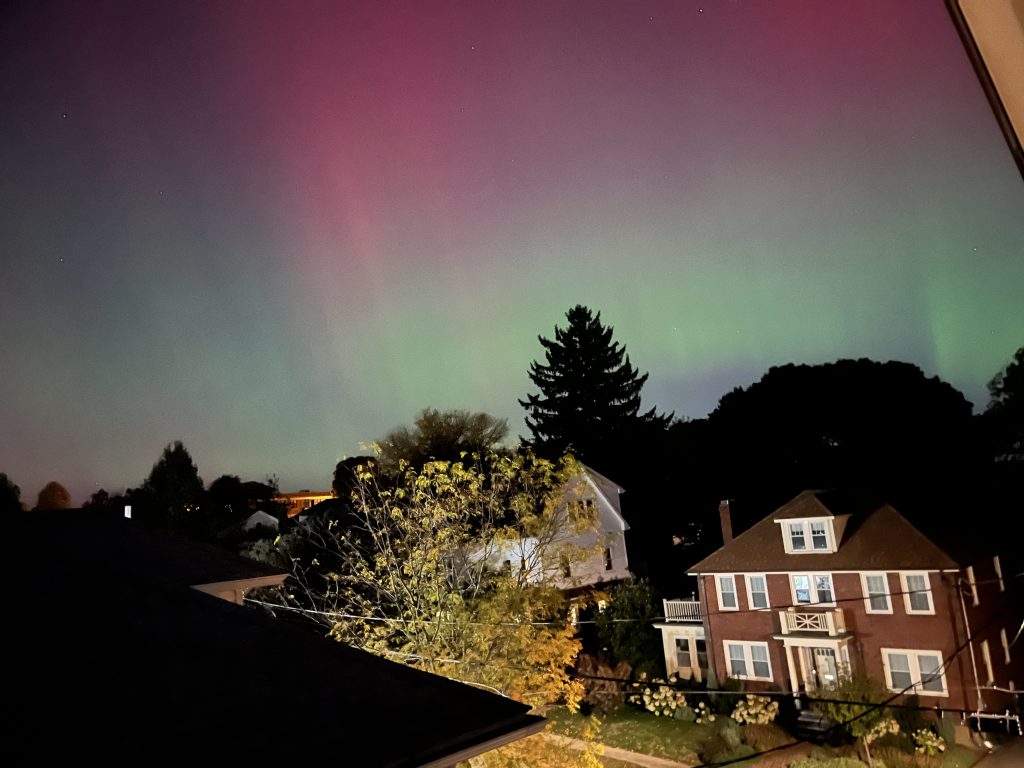
Northern Lights Visible From Belmont
The Northern Lights (aurora borealis) were visible in Belmont, MA on November 11, 2025, during a rare geomagnetic storm that brought the phenomenon across much of Massachusetts. Seen from neighborhoods like Chenery, the aurora appeared as faint waves and colors low on the northern horizon, offering residents a unique opportunity to witness a typically northern phenomenon close to home. Events like this are caused by solar activity interacting with Earth’s magnetic field, and while they are uncommon in the Greater Boston area, strong storms can make them visible even in suburban settings. Moments like these highlight the unexpected natural beauty that can be experienced right from Belmont’s neighborhoods.
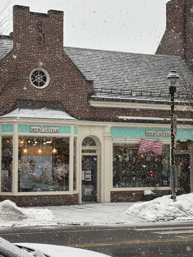
Belmont Center Shops
Belmont Center in Belmont, MA is the town’s primary commercial district, featuring a mix of locally owned shops, restaurants, and everyday conveniences along Leonard Street. Known for its walkability and neighborhood feel, Belmont Center offers residents easy access to dining, retail, and commuter options, including the nearby Fitchburg Line station. Storefronts like these reflect the area’s small-business charm and vibrant local economy, making Belmont Center a central hub for both daily life and community activity.
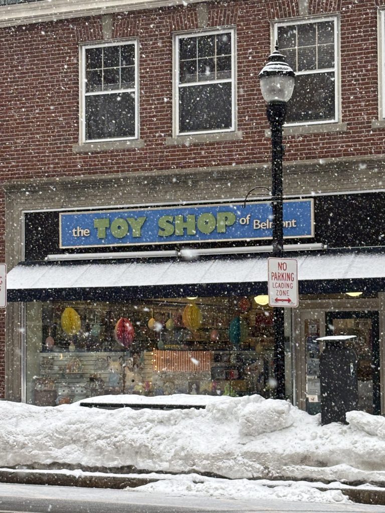
Toy Shop Of Belmont
The Toy Shop of Belmont is a long-standing local toy store in Belmont Center, known for its curated selection of high-quality toys, books, puzzles, and gifts for children of all ages. Originally a staple in the community for decades, the shop was revitalized under owner Deran Muckjian and continues to reflect Belmont’s strong tradition of independent small businesses. The store offers a thoughtful mix of educational and creative toys—from trains and building sets to toddler-friendly options—along with personalized service, including complimentary gift wrapping. With a focus on play, learning, and community connection, The Toy Shop of Belmont remains a go-to destination for families seeking meaningful, experience-driven shopping in Belmont.
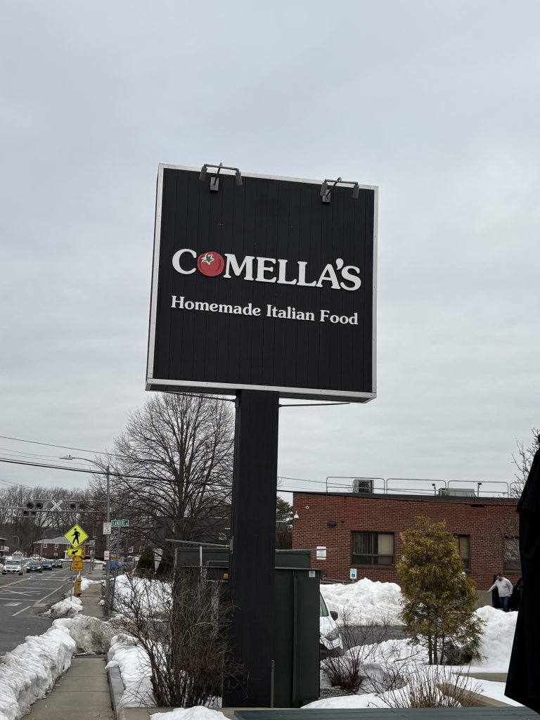
Comella's Homemade Italian Food
Comella's Homemade Italian Food in Belmont, MA is a long-standing local favorite known for its homemade Italian meals, affordable pricing, and consistent quality. Originally founded in 1988 and introduced to Belmont Center in 2011—where it quickly became a staple with its popular $5 cheese pizza pickup—Comella’s has since relocated to its current Brighton Street location. Today, it offers a spacious and often overlooked dine-in area that’s ideal for casual meals or watching sports, in addition to its well-known takeout. With a menu featuring fresh pastas, sauces, pizzas, and family-style dishes made in-house, Comella’s continues its mission of delivering high-quality, approachable Italian food for families and the broader Belmont community.
Belmont Neighborhoods
Belmont Center is the civic and historic heart of Belmont, Massachusetts. Located around the intersection of Concord Avenue, Pleasant Street, and Leonard Street, the area developed as a transportation hub in the nineteenth century and continues to function today as one of the town’s three primary commercial districts. This area undoubtedly has the best draw for shoppers and patrons visiting restaurants.
The neighborhood reflects Belmont’s transformation from a rural crossroads into a connected suburban community. Many of the buildings in Belmont Center date from the late nineteenth through mid-twentieth centuries and represent a range of architectural styles tied to the town’s growth.
Early Settlement and the Town Crossroads
The land that forms Belmont Center today was first settled in 1636 by Roger Wellington. For much of the town’s early history, the area remained largely agricultural. Activity began to concentrate in the early nineteenth century at the intersection of the Concord Turnpike (now Concord Avenue) and Colonial Watertown Road (now Pleasant Street). This crossroads gradually became the focal point for civic and commercial activity in Belmont.
The Railroad and the Birth of Belmont Center
A major turning point in Belmont Center’s development came in 1843 with the arrival of the Fitchburg Railroad. The rail line connected Belmont directly with Boston and encouraged the creation of a small commercial district around the station.
The original railroad station stood near the present Municipal Light Department building. After the first station was destroyed by fire, a structure known as Wellington Station—originally built as a private school—was moved to the site and served as the rail station from 1851 to 1879.
The current Belmont Railroad Station at 1 Common Street was constructed in 1908 after the railroad tracks were elevated and a stone-arched bridge was built. Both the station and the bridge are listed on the National Register of Historic Places.
Belmont Center as the Civic Core
Belmont Center became the town’s civic center during the late nineteenth and early twentieth centuries as several important municipal and institutional buildings were constructed nearby.
Belmont Town Hall (1881)
The present Belmont Town Hall was built in 1881 and designed by Boston architect Henry W. Hartwell in the Queen Anne style. In addition to municipal offices, the building originally housed fire equipment and later included jail cells.
The Homer Building (1897)
South of Town Hall stands the former Belmont High School building, completed in 1897 and designed by architect Eleazer Homer. The building served as the town’s high school for about twenty years and is now known as the Homer Building, functioning as a Town Hall annex.
Belmont Public Library (1902)
The town’s first purpose-built library opened in 1902 just north of Town Hall. Designed by architect William Ralph Emerson in the Classical Revival style, the building was funded by Henry O. Underwood. Today it is used by the Belmont School Department.
Municipal Buildings of the 20th Century
Additional civic structures reinforced Belmont Center’s role as the town’s administrative hub.
These include:
- The Belmont Police Station, built in 1930 in the Georgian Revival style.
Fun Fact: An image of the Belmont Police Station is shown in the TV sitcom, Brooklyn 99
- The Municipal Light Department, constructed in stages beginning in the 1920s, with its main office completed in 1934 as part of a federal Public Works Administration project.
Hollywood In Belmont: Belmont has hosted actors like Chris Evans and John Travolta when he filmed a scene for the movie: ‘A Civil Action’.
Religious and Community Institutions
One of the earliest institutions in Belmont Center was the First Church in Belmont.
The congregation formed in 1856 and played an important role in Belmont’s incorporation as a town in 1859. Its current church building at 404 Concord Avenue was constructed in 1890 and designed by the architectural firm Hartwell and Richardson.
Commercial Development on Leonard Street
While Concord Avenue became the civic corridor, Leonard Street developed as Belmont Center’s primary commercial street.
Leonard Street was laid out in 1890 and gradually filled with shops, offices, and service businesses throughout the twentieth century.
Early Commercial Buildings
One of the earliest surviving storefronts is the wood-frame building at 46–48 Leonard Street, constructed around 1890. Many other buildings evolved from earlier structures, including barns converted into retail and office spaces.
Belmont’s First Central Fire Station
The town’s first central fire station was built on Leonard Street in 1899. Designed by architect Herbert D. Hale, the brick building featured a distinctive hose-drying tower and bold architectural detailing.
Although it no longer serves as a fire station, the building remains a prominent historic structure and is protected by a preservation easement. Currently, the restaurant il Casale occupies the space. I highly recommend a visit.
In 2006 Belmont moved its Fire Station Headquarters to a newly constructed location at 299 Trapelo Road from the Belmont Center location. However, a modern and up-to-date fire house was built at 99 Leonard Street, so that the department still has a presence in Belmont Center.
The Masonic Block
The first major commercial block in Belmont Center was the Masonic Block, built in 1899 and designed by Eleazer Homer. The half-timbered Tudor-style building housed shops, a bank, the post office, and a telephone exchange. Although the structure was demolished in 1968, it marked the beginning of Belmont’s more formal commercial district. A similar looking building can be found right in Cushing Square if you are curious about how it once looked.
Growth of a Suburban Shopping District
Commercial expansion continued in the early and mid-twentieth century. On the east side of Leonard Street, a series of Colonial Revival retail buildings were constructed beginning in the 1930s by local developer Albert Locatelli, who was my predecessor as the best REALTOR in town who also developed property. Locatelli Properties on Leonard Street still exists to this day. He was also responsible for several movie theatres in the area including the Capitol Theatre next door in Arlington.
These brick storefront blocks were designed by architect John Edmund Kelley and were intended to combine urban retail functions with the scale of a suburban town center.
The Filene’s Era
One of the most prominent commercial tenants in Belmont Center was Filene’s Department Store, which opened at 75 Leonard Street in 1941.
The store was notable for an innovative delivery system in which merchandise was transported by helicopter from the company’s warehouse in Cambridge. The building later became a Macy’s location before closing in 2013, marking the end of one of the last traditional Main Street department stores in the region. While I never saw helicopter deliveries, I remember how upset the community was when the store officially closed. It was the end of an era.
Belmont Center Today
Today Belmont Center remains a central gathering place for the community. The district includes municipal buildings, historic churches, small shops, restaurants, and commuter rail access to Boston.
The area’s architecture reflects more than a century of development, illustrating how Belmont evolved from a rural crossroads into a suburban town center connected to the Boston metropolitan area.
Every year the Belmont Center Business Association hosts Town Day. Leonard Street is shut down to through traffic for a celebration that includes food and fun.
Overview
Belmont Hill is one of the most distinctive residential areas in Belmont, located northwest of Belmont Center. The neighborhood stretches roughly from Concord Avenue to the south toward Route 2 in the north, and from Clifton Street and Clairemont Road west to Marsh Street.
Over time, Belmont Hill developed into one of the town’s most prominent residential areas. The neighborhood is known for large single-family homes set on generous parcels of land, many surrounded by mature trees, stone walls, and landscaped grounds. Because the area was built gradually over more than a century, Belmont Hill includes a wide range of architectural styles.
Early Landscape and Farming History
Before residential development began, Belmont Hill was primarily farmland. In the nineteenth century the area was known as Wellington Hill and consisted of farms, orchards, pastures, and open fields.
One of the earliest significant properties was Highland Stock Farm, established by Winthrop Ward Chenery around 1850 at the corner of Concord Avenue and Somerset Street. Chenery later built a half-mile race track for thoroughbred horses on land north of Concord Avenue. Although most of the farm buildings have disappeared, the house at 741 Concord Avenue is believed to be the only surviving structure from Highland Stock Farm, though it has been altered over time.
Other agricultural operations also occupied the hill. J. Varnum Fletcher, one of Belmont’s early selectmen and a wholesale meat merchant in Boston, owned farmland in the area during the late nineteenth century. Two houses that once served Fletcher’s farm still remain today. These include a Federal-style house at 95 Clifton Street and a mansard-roofed dwelling at 1 Fletcher Road. Both are among the oldest surviving homes on Belmont Hill.
Holiday Farm and the Atkins Family
Another important estate on Belmont Hill was Holiday Farm, established in the 1860s by paper manufacturer Henry Clarke. Clarke built an Italian Villa-style mansion surrounded by terraced gardens and greenhouses on what is now the site of 567 Concord Avenue.
Although the original mansion was later demolished, two farm buildings remain from the property. The building at 96 Somerset Street once housed farm workers, while the structure at 97 Somerset Street served as the farm’s milkhouse.
Holiday Farm was later purchased by Edwin F. Atkins, a wealthy sugar broker, in 1891. Members of the Atkins family would go on to shape much of the development on Belmont Hill during the early twentieth century.
Notable Early Mansions
Several prominent houses connected to the Atkins family remain landmarks in the neighborhood.
In 1918 Edwin F. Atkins Jr. built a large brick Georgian Revival mansion at 567 Concord Avenue on the site of the former Holiday Farm house. The residence was designed by architect Henry Richardson Shepley, grandson of the famed Boston architect H.H. Richardson.
Nearby, Atkins’ daughter Helen and her husband William H. Claflin Jr. constructed their own brick Colonial residence at 531 Concord Avenue in 1925. The house was designed by architect R. Clipston Sturgis. Behind the house, Claflin built a single-story structure to display his collection of archaeological and ethnographic objects gathered from around the world. After his death, much of this collection was donated to Harvard University’s Peabody Museum.
Another notable estate is the house at 10 Juniper Road, built in 1913 for Ruth Hornblower when she married Robert W. Atkins. The residence was designed by the Boston architectural firm Chapman & Frazer, while the grounds were designed by the Olmsted Brothers landscape architecture firm. The property remained in private ownership until 1970, when it was donated to the Massachusetts Audubon Society.
Today the site forms the Habitat Education Center and Wildlife Sanctuary, which includes approximately ninety acres of conservation land. I have found memories of visiting Habitat. In elementary or middle school, classes would take trips to the visitor center and learn about indigenous wildlife. In High School, our community service requirement led me to help remove invasive plants from the forest floor. Belmont High School students were required to perform 40 hours of community service prior to graduation, and were eligible for the Presidential Community Service Award. While unfortunately the Presidential Award Program was tabled, the town still sponsors and promotes community service through their own platform.
Planned Residential Development
In 1913 several prominent Belmont residents formed the Belmont Hill Company to guide development on the hill. The group included Henry O. Underwood, J. Henry Fletcher, and Robert W. Atkins. Their goal was to manage growth while preserving the natural character of the area.
The Belmont Hill Company promoted large residential lots and careful site planning. Landscape architect Loring Underwood helped shape the development plan to preserve natural terrain, maintain setbacks, and retain scenic views. These early planning efforts predated Belmont’s zoning regulations, which were not adopted until 1925.
The first major subdivision created by the company occupied the crest of Belmont Hill between Prospect Street, Clifton Street, Rockmont Road, and Clairemont Road. Between 1920 and 1932 approximately thirty-five homes were constructed in this area by a variety of architects and builders.
Architectural Variety
Because Belmont Hill developed over a long period of time, the neighborhood includes many different architectural styles.
Early houses on the hill include Federal and Second Empire examples dating from the nineteenth century. Later construction introduced Colonial Revival, Tudor Revival, English Revival, and Ranch-style homes.
One notable example is the Theodore Miller House at 105 Juniper Road, built in 1936 and designed by architect Eleanor Raymond. The house combines elements of Colonial Revival architecture with modern design influences associated with the International Style.
Belmont Hill Village
Belmont Hill Village represents another phase of planned development. Built between 1935 and 1939, the neighborhood includes homes along Ross Road, Village Hill Road, and Dorset Road.
Although the house lots are smaller than those in earlier Belmont Hill subdivisions, many of the residences were architect-designed. Several houses were designed by architect Royal Barry Wills, known for his Colonial and Cape Cod-inspired designs.
One unusual house in the neighborhood is located at 59 Village Hill Road. The home was part of a group of model houses built by Jordan Marsh Company in 1935 in several suburban communities. Groundbreaking ceremonies were held simultaneously across the different locations.
Later Neighborhood Growth
Development on Belmont Hill continued through the mid-twentieth century. Additional residential areas created during this period include:
- Rutledge Road (1937–1941), largely Colonial Revival homes
- Country Club Estates (from the late 1930s onward)
- Amherst and Wellesley Roads (1936–1962)
- Woodbine (from the late 1930s)
- Hillcrest (1955–1978)
These projects added new homes while maintaining the neighborhood’s overall character of spacious residential streets.
Schools on Belmont Hill
Belmont Hill is also home to two private schools.
Belmont Day School was established in 1927 and later purchased the A. Donham Owen House at 55 Day School Lane in 1933. The original stone residence has been expanded significantly over time to accommodate the school. I have had the opportunity to visit the school several times, including attending a STEM fair which displayed student’s science projects. To see what 6th-8th grade students could accomplish was amazing. Some students were able to grasp complicated concepts, and some were able to code their own robots. I was both impressed and excited for friends and family members that have the opportunity to send their children there.
Belmont Hill School, a private boys’ school serving grades seven through twelve, was founded in 1923. The campus occupies approximately thirty-two acres of land originally acquired from Robert Atkins and the Belmont Hill Company. Growing up in Belmont, our peers that attended the school were always extremely well-rounded. I remember how excited I was in my first week of college out of state when I saw another student wearing a Belmont Hill athletics shirt. We became good friends fairly quickly.
Belmont Hill Today
Today Belmont Hill remains one of Belmont’s most prominent residential neighborhoods. Its combination of early farms, estate homes, planned subdivisions, and conservation land illustrates the gradual transformation of the area from rural farmland into a carefully planned suburban landscape.
The neighborhood’s varied architecture and spacious setting reflect more than a century of development while preserving many of the natural features that originally defined the hill.
Belmont Park is a small but architecturally distinctive residential neighborhood located just southeast of Belmont Center. The area sits south of Concord Avenue and includes Myrtle and Oak Streets along with portions of Goden, School, and Orchard Streets. While the name “Belmont Park” doesn’t come up as often in everyday real estate conversations as places like Belmont Hill or Cushing Square, the neighborhood stands out for something else entirely: how cohesive and well preserved its architecture remains.
The neighborhood was laid out in 1894 by developer William W. Lowe and his partner Wilbert Bartlett. They purchased about sixteen and a half acres from local farmer Thomas Richardson and subdivided the land into seventy-eight house lots, all within walking distance of the Belmont Center railroad station. At the time, the commuter rail had already made Belmont attractive to Boston professionals looking for quieter suburban homes while still maintaining an easy trip into the city.
Unlike many areas that developed gradually over decades, Belmont Park was built quickly. Most of the homes were constructed between 1894 and 1899, which explains why the neighborhood feels so consistent architecturally today. The houses tend to sit on smaller lots—generally under a quarter acre—and the streets are lined with homes that share similar proportions, materials, and design features.
Architecturally, Belmont Park is dominated by late nineteenth-century styles that were popular at the time suburban neighborhoods were first expanding outside Boston. Queen Anne houses are especially common, often featuring asymmetrical facades, decorative trim, and prominent porches. Shingle Style homes and early Colonial Revival houses also appear throughout the neighborhood. Because the development happened within such a narrow time frame, the result is a streetscape that feels unusually cohesive compared with many other parts of town.
Several local builders were responsible for much of the construction. The Bartlett Brothers were particularly active and may have built as many as fifty homes in the neighborhood. Other builders included T. S. Brown, the Melanson Brothers, and Murdock Monroe. The homes were marketed at the time as “moderately priced suburban residences,” many of which were purchased by Boston commuters drawn to the convenience of the nearby railroad depot.
One house predates the Belmont Park subdivision itself. The home at 104 School Street was built in 1883 by Thomas Richardson before the land was subdivided. The house is a good example of the Stick Style, with decorative wood trim applied over clapboard siding.
Lowe and Bartlett themselves built homes side by side at 96 and 90 School Street. These houses reflect the hallmarks of Queen Anne design, with varied rooflines, decorative details, and irregular massing. The house at 90 School Street still retains its original stable, complete with a steeply pitched roof and small cupola.
A small but interesting addition to the neighborhood came later with the development of Colonial Terrace in 1915. Three lots on Orchard Street were combined and then subdivided into five smaller parcels arranged around a circular street. Local architect Victor Wigglesworth designed five nearly identical Dutch Colonial houses for the site. Colonial Terrace still retains much of its original layout, including the circular drive, arbor benches, and a small stone well structure at the center of the cul-de-sac.
Today Belmont Park remains one of Belmont’s most cohesive historic residential areas. While buyers rarely search specifically for “Belmont Park” when looking for a home, the neighborhood often stands out once people see it in person. Its tightly grouped homes, consistent architectural styles, and tree-lined streets offer a glimpse into the type of suburban development that first brought Boston commuters to Belmont more than a century ago.
The Burbank neighborhood is South-East of Belmont Center close to the Cambridge line and is one of the more recognizable residential areas in town, particularly for anyone familiar with Belmont’s schools. The neighborhood generally centers around Burbank Elementary School and includes surrounding streets such as School Street, Orchard Street, Goden Street, and nearby residential blocks that span toward Grove Street and Concord Ave.
Much of Burbank developed during the late nineteenth and early twentieth centuries as Belmont transitioned from a rural farming town into a streetcar and commuter rail suburb of Boston. The proximity to Belmont Center and the railroad station made the area especially attractive for commuters, and the neighborhood gradually filled in with single-family homes as Belmont’s population expanded.
Architecturally, Burbank reflects this transitional period in Belmont’s growth. Many of the homes date from the late 1800s through the early 1900s and represent a mix of Queen Anne, Colonial Revival, and early twentieth-century suburban house styles. Unlike neighborhoods that were built as tightly planned subdivisions, Burbank developed more gradually, which gives the area a wider mix of house sizes, styles, and lot layouts.
The neighborhood takes its name from the Burbank School, one of Belmont’s elementary schools and an important community anchor. Schools have historically played a significant role in shaping Belmont’s residential patterns, and areas surrounding them often became desirable locations for families as the town grew. I attended Burbank with my brother in the early 1990s, and have fond memories visiting friends that I went to school with in the surrounding neighborhoods.
Today, Burbank remains a classic Belmont residential neighborhood—close to Belmont Center, walkable to schools and parks, and made up largely of single-family homes built during the period when Belmont was first establishing itself as a suburban community.
Clark Hill is a residential neighborhood located just south of Belmont Center, roughly bounded by Common Street to the east, Waverley Street to the south, Thomas Street to the west, and Clark Street to the north. The neighborhood sits on elevated ground, and that topography plays a big role in how the area was developed and how it feels today. Many of the homes are positioned along gently rising streets, with mature landscaping and stone walls that give the neighborhood a distinctive hillside character.
While some development on Clark Hill began in the mid nineteenth century, much of the neighborhood as we know it today took shape after 1909. That year, the Belmont Associates began subdividing portions of the hill into residential lots, laying out streets such as Blake Street, Clover Street, and Kilburn Road. The goal was to create a neighborhood of well-designed single-family homes that took advantage of the hilltop setting.
Because the area was planned and built during the early twentieth century, many of the homes share architectural characteristics common to that period. English Revival and Craftsman-style houses appear throughout the neighborhood, often featuring steep rooflines, decorative half-timbering, and prominent porches. Many homes were designed by architects rather than built purely as speculative housing, which contributes to the overall sense of individuality and quality in the streetscape.
Lot sizes on Clark Hill tend to be somewhat larger than in some of Belmont’s earlier subdivisions, and the natural landscape was incorporated into the development. Stone retaining walls, mature trees, and varied elevations help define the character of the neighborhood and give it a slightly more secluded feel despite its proximity to Belmont Center.
Today Clark Hill remains a quiet residential area that reflects the early twentieth-century period when Belmont was expanding as a commuter suburb of Boston. Its hillside setting, architecturally distinctive homes, and proximity to Belmont Center continue to make it one of the more recognizable residential pockets of town, even though the neighborhood name itself may not appear as frequently in everyday real estate searches as some of Belmont’s larger districts.
The Chenery neighborhood overlaps with the Payson neighborhood and Presidential District (a moniker for a neighborhood with streets named after our Presidents on the North side of Washington Street). I know the area very well because I grew up in and currently live on the same street adjacent to the school.
The Chenery neighborhood is located south of Belmont Center, closer to the Watertown line, and takes its name from Chenery Middle School, one of the town’s central public school campuses and named after an estate owner early in Belmont’s history. The area includes residential streets surrounding the school
Much of the neighborhood developed during the late nineteenth and early twentieth centuries as Belmont transitioned from a rural farming community into a commuter suburb of Boston. Its location between the railroad station at Belmont Center and the streetcar routes along Trapelo Road made the area especially convenient for Boston commuters, and residential construction gradually filled in the surrounding streets.
Architecturally, the Chenery area reflects this early suburban growth. Many homes date from the late 1800s through the early 1900s and include a mix of Queen Anne, Colonial Revival, and early twentieth-century house styles. Because the neighborhood developed incrementally rather than through a single large subdivision, there is a noticeable variety in house size, lot layout, and architectural details.
On the south side of my street, an old farm wall made of large stone traverses almost the entire length of the street. When my parents purchased the house, pear trees and crabapple trees were present on the property as the land once belonged to an orchard. In childhood, I recall my Brother unearthing old porcelain pieces from broken plates and coins. Somewhere on my parent’s lot still remains a time castle from the 1990’s.
The presence of Chenery Middle School gives the neighborhood a strong civic anchor. Schools have historically influenced residential development patterns in Belmont, and areas surrounding them often became established family neighborhoods as the town expanded. The middle school has also continued to expand. Consolidation has brought more students there as of the last couple of years. The venue also hosts numerous town events and leases to a school on Sunday afternoons. The site has begun construction on a brand new park, replacing the original one built with the school building in 1996-1997. The year it was completed, I entered the school as a 5th grader, and was the first class to complete four years at the new school.
Today the Chenery area remains a classic Belmont residential pocket—close to Belmont Center, walkable to schools and parks, and defined largely by early twentieth-century single-family homes. While the neighborhood name itself is not always used in real estate listings, its central location and proximity to both Belmont Center and Waverley Square make it a well-known and well-established part of the town’s residential landscape.
I can’t speak for all neighborhoods like I can Chenery, and I feel like I have the best neighbors anyone could ask for. By walking around with my dogs I feel like I’m stopped at every third house catching up with the residents. I attend social events with the people around me, and enjoy the support the neighborhood provides. I’m biased, but the important thing to note is that in a general sense, Belmont has not lost what has made it such a great community. In a post-covid world, I do not feel isolated on my own block.
The Grove Street neighborhood is located along the Eastern border of Belmont, on the Cambridge line with quick access to Watertown at the end of Grove Street, on the other side of Belmont Street. Because of its location near several town borders, Grove Street has long served as an important local corridor linking Belmont with neighboring communities, and is popular with commuters heading into Cambridge and the city of Boston.
Historically, the Grove Street area developed gradually as Belmont transitioned from a rural landscape of farms and open land into a residential suburb of Boston, much like Belmont’s other neighborhoods. During the nineteenth century, much of the surrounding land consisted of agricultural fields and small farms. As transportation improved and Belmont became more connected to Boston through rail and streetcar lines, residential construction slowly began to fill in the area.
Unlike some Belmont neighborhoods that were created through a single planned subdivision, Grove Street evolved more organically over time. As a result, the housing stock reflects several different periods of Belmont’s development. Many homes date from the late nineteenth and early twentieth centuries and include a mix of Colonial Revival, Craftsman, and early suburban house styles. In some areas, later twentieth-century homes were added as remaining parcels of land were developed. There is also a healthy number of two and three family homes located in the area.
Because the neighborhood grew incrementally, the streetscape tends to feel varied. Houses differ in size, architectural details, and lot configuration, creating a mix that reflects the broader evolution of Belmont’s residential development. Mature trees and established yards contribute to the neighborhood’s long-standing residential character.
Today the Grove Street area remains a primarily residential part of Belmont with convenient access to multiple commercial centers via Belmont Street and Concord Ave, as well as Route 2 over the Cambridge line, which serves residents access to I-95. This connectivity continues to make the neighborhood attractive to residents seeking a Belmont location that offers both a quiet residential setting and easy access to surrounding communities.
I have many fond memories of the neighborhood because Grove Street Park, recipient of some recent updates, was a major sports hub and destination. I played soccer games there and lost consecutive little league championship games. I’m still bitter about it.
Harvard Lawn is a small residential neighborhood located just east of Belmont Center and north of Concord Avenue, close to the Cambridge line. Though the name is not always used in everyday conversation, the area represents one of Belmont’s early planned residential subdivisions developed during the late nineteenth century as the town began to grow as a commuter suburb of Boston.
The neighborhood developed at a time when Belmont was transitioning from farmland and scattered estates into a more organized suburban community. The arrival of the Fitchburg Railroad in 1843 had already made Belmont accessible to Boston commuters, and by the late 1800s developers began subdividing land near Belmont Center into residential house lots. Harvard Lawn was one of those early subdivisions, offering homes within easy walking distance of the railroad station and the emerging civic center.
Because much of the neighborhood was built during a relatively narrow period of time, the architecture reflects the popular residential styles of the late nineteenth and early twentieth centuries. Queen Anne and Colonial Revival houses are common throughout the area, often featuring decorative woodwork, porches, and traditional clapboard siding. The homes tend to sit on smaller lots than those found on Belmont Hill, but the streets remain lined with mature trees and established landscaping that contribute to the neighborhood’s historic character.
Like many Belmont neighborhoods developed during this period, Harvard Lawn was designed to appeal to professionals commuting into Boston. The proximity to Belmont Center made it especially convenient for residents to access the railroad, local shops, and civic institutions that were forming around Concord Avenue and Leonard Street.
Today Harvard Lawn remains a quiet residential pocket near Belmont Center. Its location provides easy access to local shops, restaurants, schools, and public transportation while preserving much of the architectural character established during Belmont’s early suburban growth. While the neighborhood name itself is not commonly used in real estate searches, the homes within the area continue to reflect Belmont’s late nineteenth-century development as a commuter-oriented suburb of Boston.
Payson Park is tucked into the southern side of Belmont near the Watertown line, anchored by Trapelo Road and just a short distance from Cushing Square. It sits across the street from Oakley Country Club at the border and stretches to Payson Rd. It is located between the North/South traversing roads of Common Street and School Street. As with other Belmont it’s not a name you’ll hear come up all the time in search conversations, but it’s one that tends to resonate once buyers start exploring this part of town.
This section of Belmont took shape between the late 19th and early 20th centuries, during a period when the town was steadily transitioning into a commuter-friendly suburb. Its location along established roadways made it a logical place for residential growth, and over time, individual parcels were developed into the neighborhood you see today.
What stands out here is the range of housing styles. Because development happened over an extended period rather than all at once, the architecture isn’t uniform. You’ll find a blend of Queen Anne, Colonial Revival, Craftsman, and other early suburban styles, often with distinct details that reflect the era they were built in. That variety gives the neighborhood a more organic feel compared to areas that were built in a single phase. Some of my favorite homes are tucked away in the neighborhood. There are some stately brick tudor colonials that look fantastic.
The setting is primarily residential, with tree-lined streets and a consistent sense of scale throughout. Homes are set on modest but well-proportioned lots, and the overall layout reflects a time when neighborhoods were designed to be walkable and connected, without feeling overly dense.
A school once sat at the location of Payson Park, the focal point of the neighborhood which burned down in 1974. There’s an old legend in Belmont that every time the town needs a new school, a convenient fire starts the demolition process. These rumors are unsubstantiated of course, but four Belmont schools have had fires in its history, as logged by Wicked Local
Payson Park may not carry the same name recognition as some of Belmont’s more well-known sections, but it represents a classic example of the town’s early residential growth—steady, varied, and shaped by how people actually lived and moved through the area.
What I really like about the Payson Park Neighborhood is its proximity to Cushing Square. While secondary to Belmont Center, it remains one of the Town’s focal points and commercial areas. With the 73 Bus line to Harvard Square, I rode the bus many times, especially for Super Bowl parades in the early 2000s. The close proximity to restaurants, shops, and public transportation make the location highly desirable. There definitely remains a strong suburban feel, as major roadways surround the location, but do not travel directly through it with the exception of Payson Road. The reservoir is a great place to walk, the Benton Library has historically always been there for me, and walks to the square happen frequently to this day.
I’ll always have a soft spot for Payson as its where I grew up. Technically I live in the Chenery Neighborhood, but Payson Rd, and much of my childhood are only a few houses away.
Snake Hill is one of the most distinct and, frankly, overlooked pockets in Belmont. Probably because there are only 6 houses located there. Tucked just north of Pleasant Street and a short distance from Belmont Center, it’s a small hillside enclave that feels completely different from the rest of the town—and that’s by design.
Developed in the early 1940s by architect Carl Koch, Snake Hill represents one of the earliest examples of modern residential design in the country. At a time when most of Belmont was defined by Colonial and traditional architecture, this area took a different approach entirely. The homes were designed with simplicity, function, and their natural surroundings in mind—clean lines, open layouts, and a strong connection to the landscape.
There are only a handful of homes here, all situated along Snake Hill Road, and the limited scale is part of what makes the neighborhood so unique. It’s not a place with turnover or volume—it’s more of a curated residential setting that has remained largely intact since it was first developed. I have never had the pleasure of showing one of the 6 homes.
From an architectural standpoint, Snake Hill stands apart. Even if you can’t see it while driving by. These homes don’t follow the patterns you see elsewhere in Belmont. Instead of symmetry and ornamentation, the focus is on form, light, and how the structures sit within the hillside. It’s a completely different lens on what residential development looked like during that period.
Location-wise, you still get the convenience of being close to Belmont Center and major commuting routes, but the setting feels more private and removed. That contrast is part of the appeal.
Snake Hill isn’t a neighborhood that comes up often in typical home searches, but for buyers who value architecture and design—or just want something that doesn’t feel like everything else—it’s one of the more interesting areas in town.
Not to be confused with Walnut Street, which is located West of this neighborhood, Walnut Hill is actually my favorite neighborhood in town. It may be yours too and you just don’t realize it. Walnut Hill is home to Hillcrest Rd. There’s a chance you have been down that street close to Halloween. The street is known for its stately homes, and skeletons posing in different exhibits. The tradition started during the COVID-19 Pandemic and has continued over the years. Most if not all of the residents take part, and this street is the sole reason I haven’t had a trick-or-treater on my block since this started. Cars line up to drive down the road in peak hours, and over the last six years it just may be the most traversed street in town excluding commuter traffic.
Back to the neighborhood. Walnut Hill sits near the geographic center of Belmont, in between some of the town’s more recognizable neighborhoods, but it tends to fly a bit under the radar by name. It’s roughly bordered by Common Street to the West, Hillcrest Rd to the North, Goden Street to the East, and Fairmont Street to the South. It’s not smaller than Snake Hill, but certainly one of the smallest named neighborhoods in town.
The area began taking shape in the early 1900s, mostly between 1910 when the neighborhood was laid out, through 1920. There’s a good mix of housing stock here, featuring craftsman style homes with stucco siding, English revival, prairie style, Dutch colonials, and more.
One of the defining characteristics of Walnut Hill is how it’s laid out. The streets are residential and relatively quiet, with homes set on well-sized lots and a noticeable emphasis on landscaping. It doesn’t have the density of some of the more compact neighborhoods closer to commercial centers.
From a location standpoint, Walnut Hill benefits from being centrally positioned. Belmont Center, Cushing Square, and Waverley Square are all accessible, along with the main routes that connect Belmont to Cambridge, Watertown, and Boston. That balance of accessibility and residential feel is a big part of the draw.
Waverley Square anchors the southwest corner of Belmont and functions as one of the town’s three primary commercial centers. Located along Trapelo Road near the Waltham and Watertown lines, it’s an area that blends everyday convenience with a long history tied to Belmont’s growth as a commuter suburb. My wife and I purchased our first condominium together on Thayer Rd, so the Square always has a special place in my heart.
Like Belmont Center, Waverley’s development is closely tied to transportation. The arrival of the Fitchburg Railroad in the mid-1800s helped transform what had been a more rural area into an active node of movement and commerce. Over time, the square evolved into a streetcar suburb, with surrounding residential streets filling in as access to Boston became more reliable and routine.
The layout here is a little less formal than other parts of town, which gives Waverley Square its character. Roads converge at slightly irregular angles, and the commercial buildings reflect that—smaller-scale storefronts, mixed-use properties, and structures that were built over time rather than as part of a single plan. Architecturally, you’ll see a mix of early 20th-century styles, often practical in design but consistent with the era.
The surrounding neighborhoods mirror that same evolution. Homes range from mid-19th century properties to early and mid-20th century construction, creating a varied housing stock that appeals to a wide range of buyers. It’s not uniform, and that’s part of the appeal.
From a lifestyle standpoint, Waverley Square is one of the more functional areas in Belmont. You have direct access to the commuter rail, a bus route into Harvard Square, and a cluster of local shops, restaurants, and services that make day-to-day living straightforward. It’s a location that tends to prioritize convenience without losing the feel of a residential neighborhood just a few streets away. That’s why I loved living there. We would frequently walk to Beaver Brook reservation, handle our banking at Watertown Savings, and enjoy lazy Saturday mornings after picking up Dunkin Donuts. It was at Dunkin that I first met Rachid Smairi. Rachid was one of the most pleasant people you can come across. The way he interacted with customers was always special and he formed relationships with his regulars. It’s no surprise he now owns and runs Bellmont Caffe in Belmont Center. I highly recommend a visit.
Waverley Square may not carry the same traditional “center” identity as Belmont Center, but in practice, it plays just as important a role. It’s a hub of activity, shaped by how people move through the area, and continues to be a key part of Belmont’s overall landscape for both residents and people traveling through the area.
Historical districts and named neighborhoods sometimes overlap. That seems to be the case with Wellington. With the Pleasant Street historic district located to the North, and Common Street to the South West, I’m calling Wellington the area centered around the Wellington School. My boundaries are Concord Ave to the North, Goden St to the East, Common Street to the West, and Fairmont Street to the South. These aren’t the official boundaries of the area by any means, but my best approximation based on the location of the surrounding neighborhoods which overlap, including Belmont Park. The area is at the base of a large hill, that peaks near the Payson Neighborhood.
Wellington has a lot going on, especially in warmer weather. The Concord Rd. The boundary has historic Wellington Station, the first station in Belmont on the Fitchburg line. It’s an iconic building for the town, and the yellow building has an octagon shape. It sits directly in front of the railroad bridge which I would call the “entrance” to Belmont Center. To the West is the Underwood Pool. Located next to the new Belmont Public Library (2026),, and across from the new Skip Viglirolo Rink (2025). The area does not lack things to do, just the parking to do it. Limited parking lot space keeps Concord Ave busy for most of the day.
Contemporary Belmont is not known broadly for its contributions toward global warming and releasing greenhouse gasses, and I am so sorry that I have to disappoint you. Through a large portion of its history the town of homes was known for being a town of market gardens. Belmont was extremely successful as a farm community. The Winn Brook School, the anchor for the area was also roughly where rows of greenhouses were built for produce to grow year round. Those greenhouses were heated by coal, and smokestacks were visible throughout the area. Crops that were produced here include celery, carrots, onions, beets, apples, pears, watercress, lettuce, dandelion, squash, and tomatoes. For more information on the history, Jane Sherwin has a great write-up in the Belmont Citizen Forum’s newsletter.
I was being facetious about Belmont’s contribution to global warming, but I wanted to highlight how very different the whole town was, especially the Winn Brook neighborhood today. I would describe Winn Brook as the quintessential Boston suburban neighborhood. Businesses line Brighton Street on the Cambridge line to the East, Pleasant Street separates the area from Belmont Hill to the North, the West is marked by Belmont High School and Belmont Center, and the South is bordered by Concord Ave. Tucked away on side streets are beautiful A-Frame and Garrison Colonials, Capes, and ranches. Our Team member Bobby grew up on Statler Road and still lives in the neighborhood with his Family.
If you are from out of town and not so familiar with the neighborhood, you may be aware of Joey’s Park. Associated with Winn Brook Elementary, the once arsenic-laden wooden park of my childhood had a makeover that kept its character and allure. The Park was named after a local legend, Joey O’Donnell, a Belmont resident born with cystic fibrosis. Joey was known for leadership, and his infectious personality. The park was funded and built by his friends in honor of who he was in 1986. Joey’s Park remains a destination in town for littles with wiggles.
Prominent Belmont businesses are also in the area. Freiner Plumbing, owned by former classmate Clark Freiner is headquartered on Brighton Street and found on our Recommended Contractors & Vendors List. Fresh Pond Animal Hospital, the veterinarian my family has taken three generations of dogs to, is located on Flanders Rd. Also in the world of pets is the Crate Escape, located across Brighton Street along with Ace Hardware Hillside Gardens, where I fill my propane tanks for the grill.
Winn Brook offers a lot of convenience, and not just because it has one of Belmont’s three Dunkin locations. Pleasant Street, which is route 60, located to the North provides direct access to Route 2, Belmont Center, and Arlington. You can also find access to Medford, Winchester, and Somerville. Taking Brighton Street South will provide access to the Cambridge line to the East, and further South is Watertown if you continue down Grove Street. Living on the East side of Belmont has incredible access to public transportation at Alewife Station in Cambridge as well as Soldiers Field Rd and Storrow Drive to the city of Boston.
Commuting & Accessibility
Of course, living in Belmont does not mean you have to stay in town on your Saturday. One of Belmont’s best assets is its close proximity to, well, everything. I-90 the Mass Pike is accessible over the border in Watertown, Storrow Drive and the city of Boston are right there over the Eastern town lines, and Route 2 provides easy access to 95 (but watch out for rush hour traffic). Public transportation also makes for easy escapes. The MBTA 73 Bus line from Waverley Square travels all the way to Harvard Square via Trapelo Road and Belmont Street in town, with the 74 heading to the same destination via Concord Ave. The Fitchburg Commuter Rail line to North Station means catching a game at the Garden and access to the rest of Metro Boston is right there. You can pick up stops in Waverley Square or Belmont Center. Parking at Alewife Station over the Cambridge line also grants you easy access to the Red Line.
- Two MBTA Commuter Rail stations: Belmont Center and Waverley (Fitchburg Line)
- Approximately 16 minutes to North Station (Times vary by time and day)
- Easy access to Route 2, Route 60 (Pleasant Street), I-95/128, and major regional corridors
- Close proximity to Alewife Station (Red Line and buses)
- Access to Harvard Square via the 73 Line
Belmont Is Bicycle Friendly
I haven’t jumped on my bike in years, but its nice to see so many residents taking advantage of getting to work easily, getting some exercise, and taking cars off the road for commutes. So after you purchase your Bike at Wheel Works (non-negotiable, sorry, I don’t make the rules), you can take advantage of the accessible location and two projects geared toward our two-wheeled friends.
The first project was to create a dedicated bike lane that spans all the way down Concord Ave. To put it lightly, it was not without controversy. The plan involved narrowing the width of the road, having parallel spaces to the right, and to the right of parked cars there is a dedicated bike lane. I do not question the intent or complexity of city planning, however drivers getting out directly into traffic on the left and bikers flying by on the right is typically criticized in casual conversation. I don’t have a better solution, but awareness promotes safety. I’m always of the opinion that progress toward making something better, more sustainable, or accessible is worth the effort. So be aware when you are on Concord Ave.
Concord Avenue Bike Lane Striping Pans
Concord Avenue Separated Bike Lanes Map
The second project is the Community Path. In 1999 a project began to connect Boston to Northampton for pedestrians and bicyclists. The path is known as the Massachusetts Centrai Rail Trail.
Public Transportation Schedules And Availability
MBTA Fitchburg Line Schedule and Information
MBTA Fitchburg Line Schedule 2026.pdf
MBTA Fitchburg Line Weekend Diversion 2026.pdf
MBTA Fitchburg Line Storm Schedule 2026.pdf
Bus Schedule
73 Line Harvard Station via Trapelo Rd
74 Line Harvard Station via Concord Ave
Belmont Town Transportation
This combination makes Belmont attractive to professionals working in Boston, Cambridge, and surrounding innovation hubs.
Coldwell Banker - Belmont
© 2024 The DelRose McShane Team
© Coldwell Banker 2023 – 2024. All Rights Reserved. Coldwell Banker and the Coldwell Banker logo are trademarks of Coldwell Banker Real Estate LLC. The Coldwell Banker® System is comprised of company owned offices which are owned by a subsidiary of Anywhere Advisors LLC and franchised offices which are independently owned and operated. The Coldwell Banker System fully supports the principles of the Fair Housing Act and the Equal Opportunity Act.
